

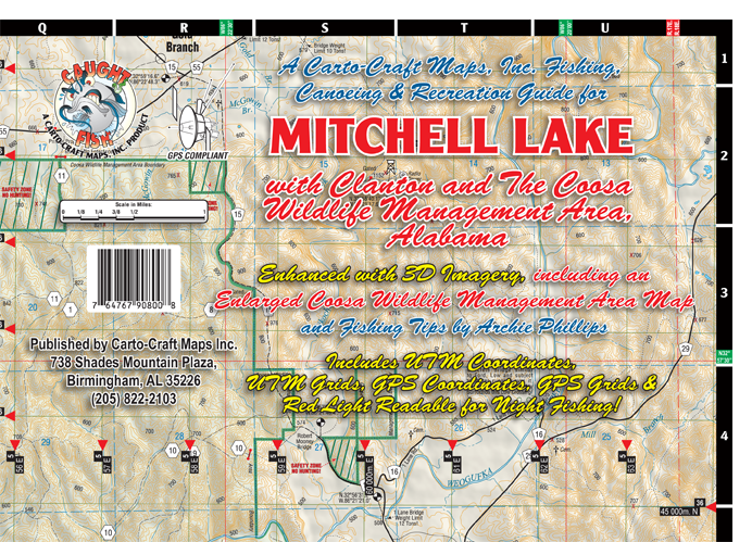
| Name: | Mitchell Lake |
| Size: | 39"W x 24.5"H |
| Color: | Full Color |
| Retail Price |
Paper: $4.95 Water Proof: $8.95 Laminated Wall Map: $14.95 |
| *PRICES SUBJECT TO CHANGE AND DOES NOT INCLUDE SHIPPING AND HANDLING | |
| ADD TO CART | |
FEATURES
| Shaded Relief | |
| Regional Inset Map | |
| Red Light Readable | |
| Paper, Water Proof, and Laminated Wall Map Versions Available | |
| UTM Coordinates, UTM Grids, GPS Coordinates and GPS Grids | |
| Fishing Tips By Thomas Lang |
|
MITCHELL LAKE Mitchell Lake: Mitchell Reservoir is a 5,850 acre Alabama Power Company hydroelectric impoundment located about ten miles east of Clanton and I-65 in central Alabama. Mitchell is the smallest impoundment of the Coosa River chain of lakes. The Coosa River lakes are fertile, assuring high production of shad, which results in excellent growth and abundance of game fish species. Mitchell Lake comprises 5850 acres of surface area with 147 miles of shoreline. The maximum depth is 90 feet. Weogufka Creek: The Low Water Bridge to Ford section of Weogufka Creek in Alabama is 9.6 miles long and is a class I-II stretch of white water according to the American Whitewater Assosciation. This stretch of Weogufka Creek, Alabama has an average gradient of 15 fpm. |