

| Name: | Yates Lake, Thurlow Dam and Lake Tallassee |
| Size: | Inset size depends on Associated Product |
| Color: | Full Color |
| Retail Price |
Paper: N/A Water Proof: N/A Laminated Wall Map: N/A |
| THIS IS NOT A SEPARATE PRODUCT BUT IS INCLUDED AS AN INSET OR APPEARS ON THE BACK OF OTHER CURRENT PRODUCTS APPLICABLE TO THIS AREA. | |
FEATURES
| Shaded Relief | |
| Red Light Readable | |
| Lake and Dam Statistics |
|
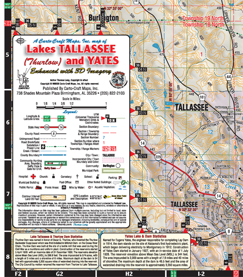
YATES LAKE, THURLOW DAM & LAKE TALLASSEE Lake Tallassee & Thurlow Dam: Thurlow Dam was named in honor of Oscar G. Thurlow who invented the Thurlow Backwater Suppessor which was first installed in Mitchell Dam on the Coosa River chain. Thurlow Dam was built at the site of a textile mill that was used during the Civil War as a munitions and uniform plant. Construction of the reservoirs started 5 April 1928 with an inservice date of 31 December 1930. The reservoirs elevation above Mean Sea Level (MSL) is 288.8 feet. The area impounded is 574 acres with a length of 3 miles and a shoreline of 6 miles. Maximum depth at the dam is 54 feet with approximately 3,300 square miles of watershed draining into the reservoir. The City Council by motion renamed the reservoir from Thurlow to Lake Tallassee. |